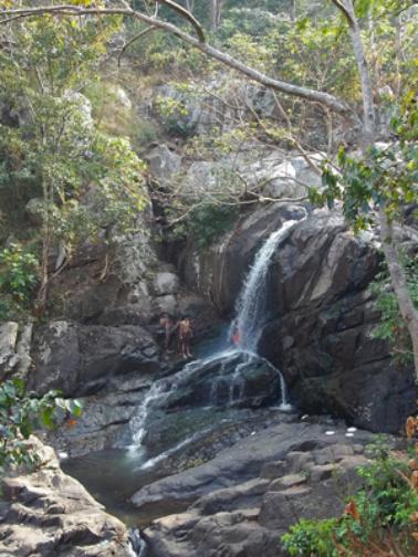
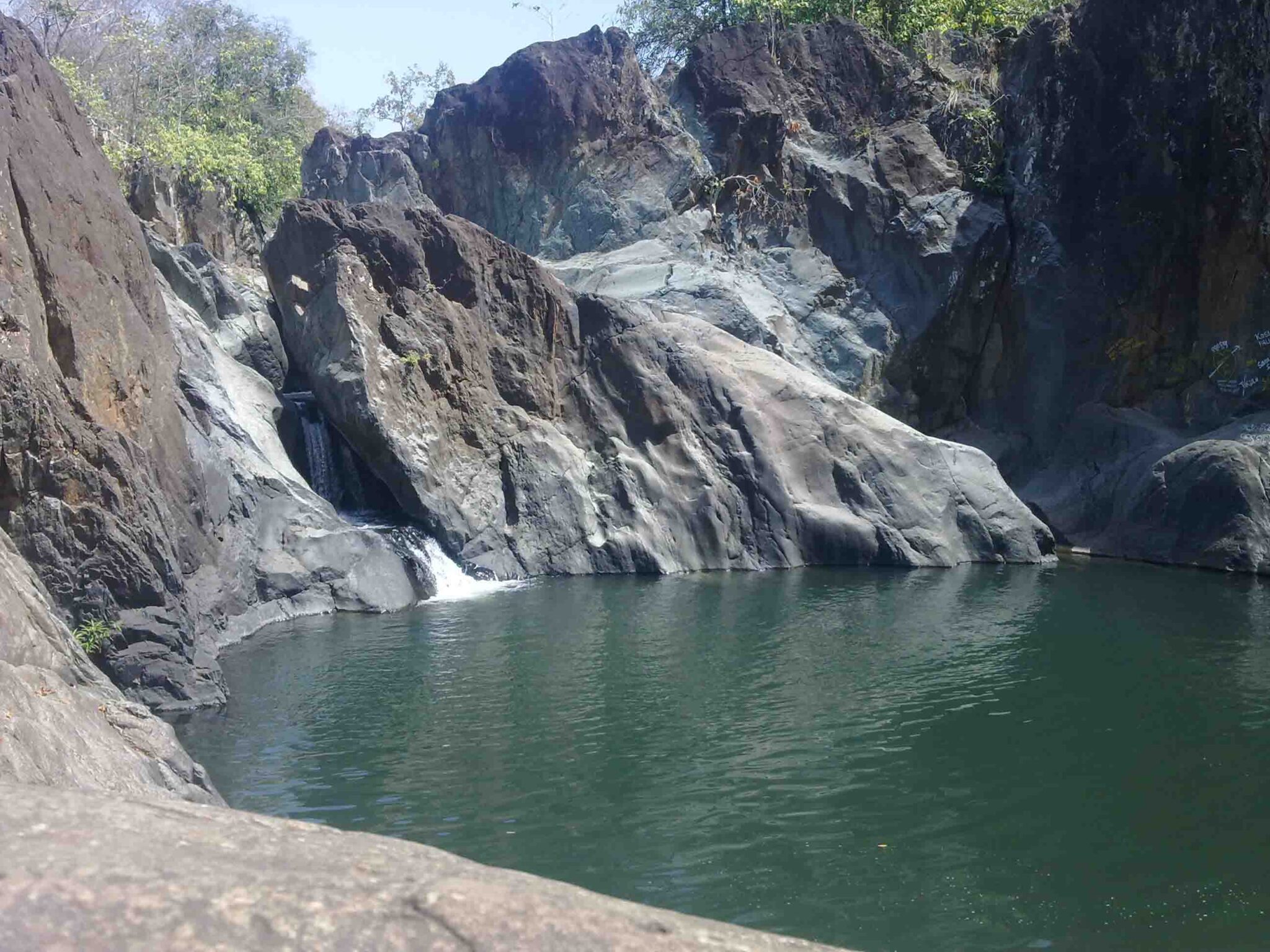
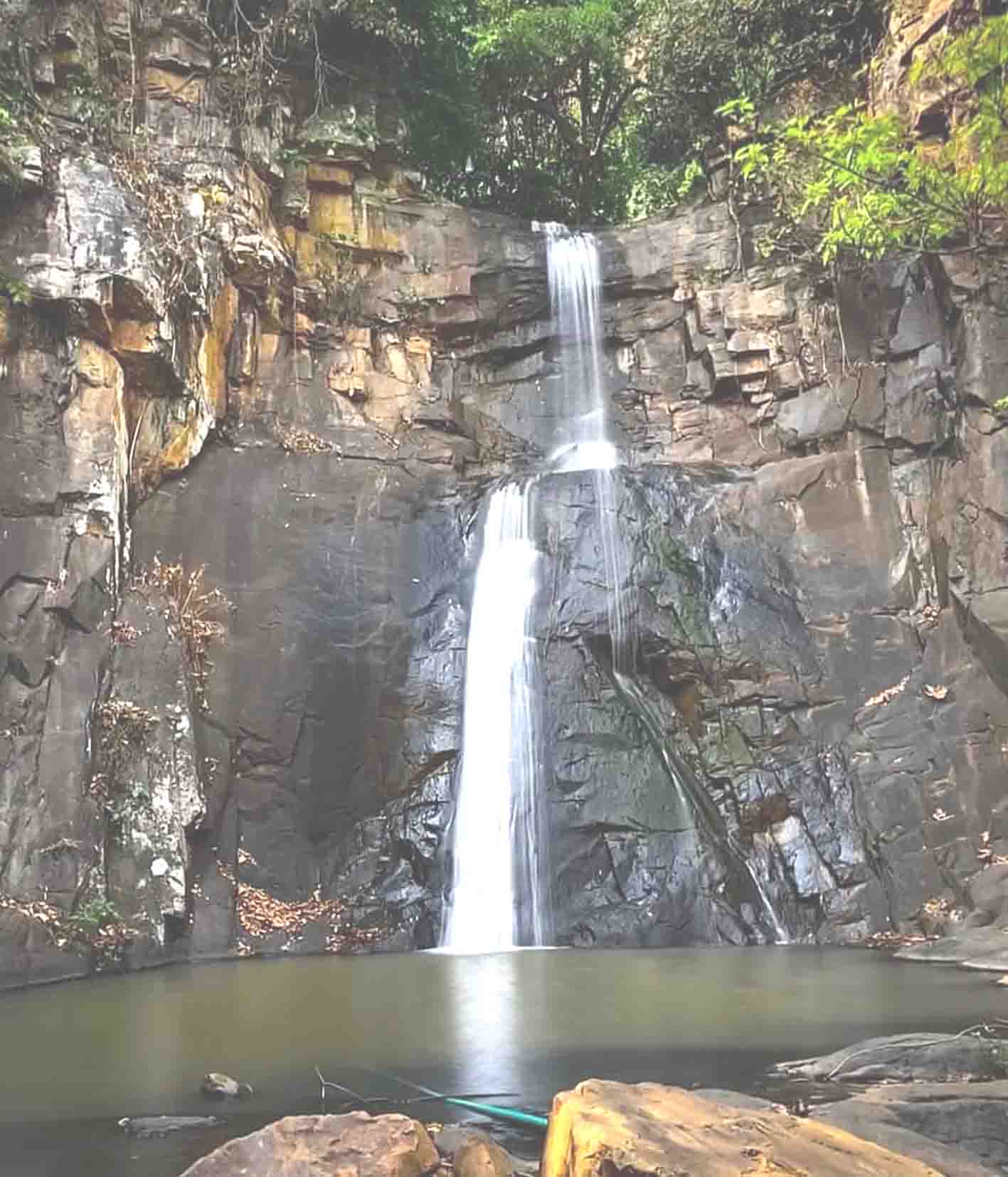
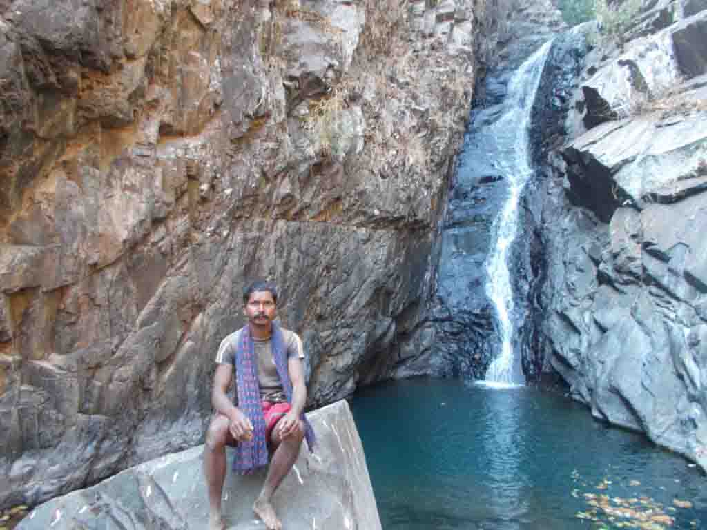
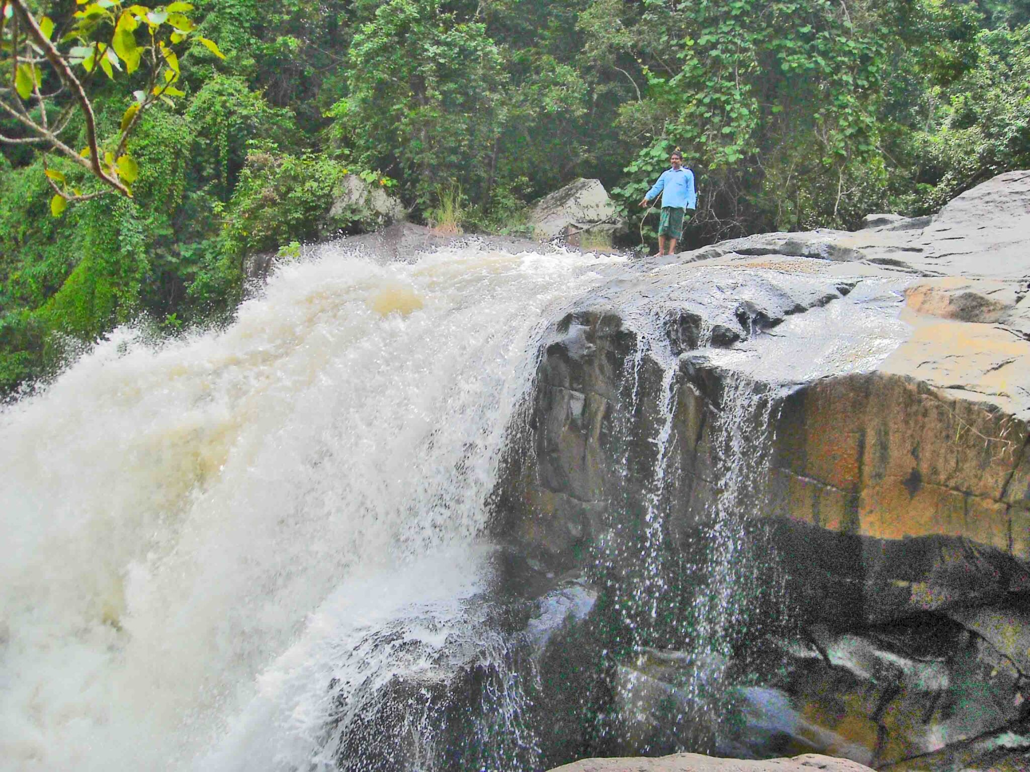
Tourists can visit sitakund waterfall without permission. Sitakunda waterfall is located within Similipal National Park in the Mayurbhanj District which is 2 km distance from Pitthabata entry gate of Similipal and 20KM from district head quarter Baripada. Original source of emerge from KaliPahad and flow from top of hill about 25 feet height to a round shape deep tank. Bathing is not safe in this tank as the depth tank is about 30feet deep but one can bath in Laxman kunda in which the water is fell down over a stone bed. It is about 1km distance from Sitakund Forest Resort.
SITAKUND WATERFALL AERIAL VIEW
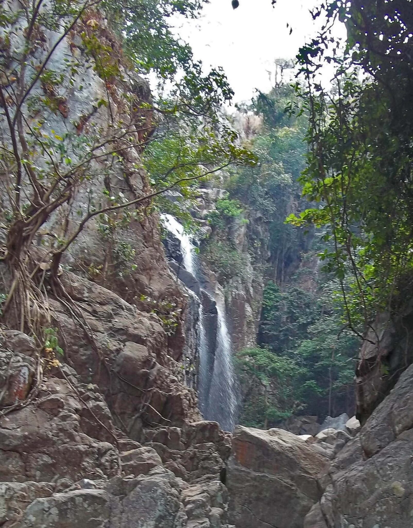
SITAKUNDA NALA emerge from Kali Pahad hill of Similipal which nala merge with Palapala river at Pitthabata and create three waterfalls namely Sitakunda waterfall, Laxman kund waterfall and Rama kund waterfall step by step during flow downward from Sitakund hill.
SITAKUND WATERFALL FRONT VIEW
21°55′44″N 86°34′16.9″E is GPS LOCATION OF Sitakund Waterfall
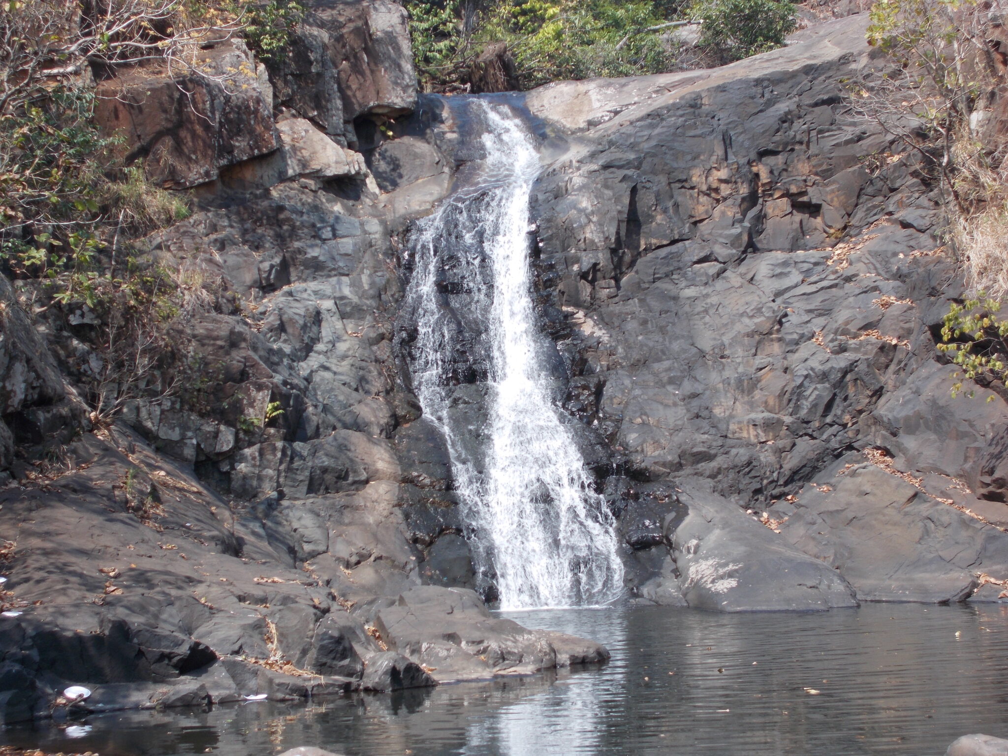
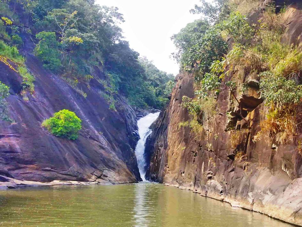
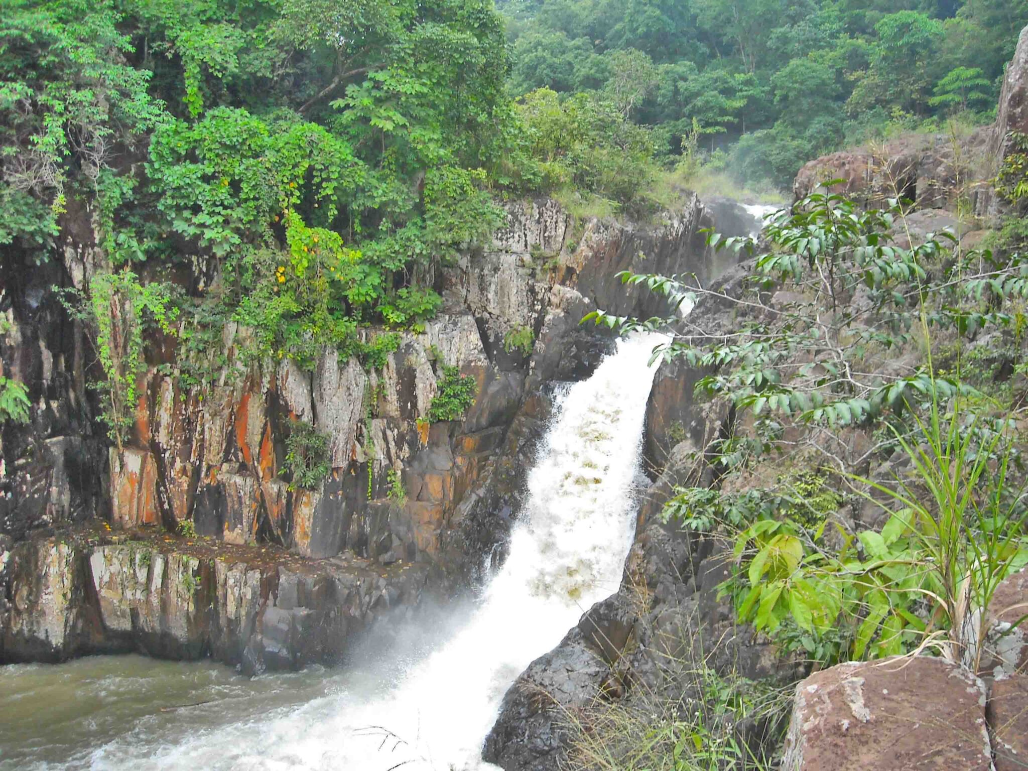
Laxman kund WATERFALL
Laxman Kunda is the 2nd waterfall of Sitakund Nala which is not only a nice waterfall but also visitors can enjoy in bathing in this fall.
21°55′43.4″N 86°34′16.5″E is the GPS LOCATION of LAXMAN KUNDA WATERFALL
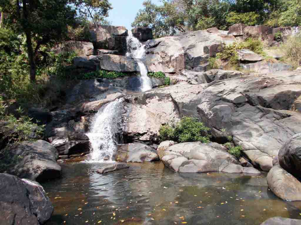
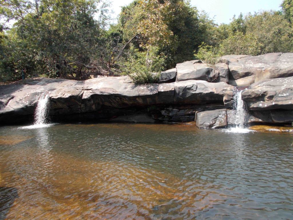
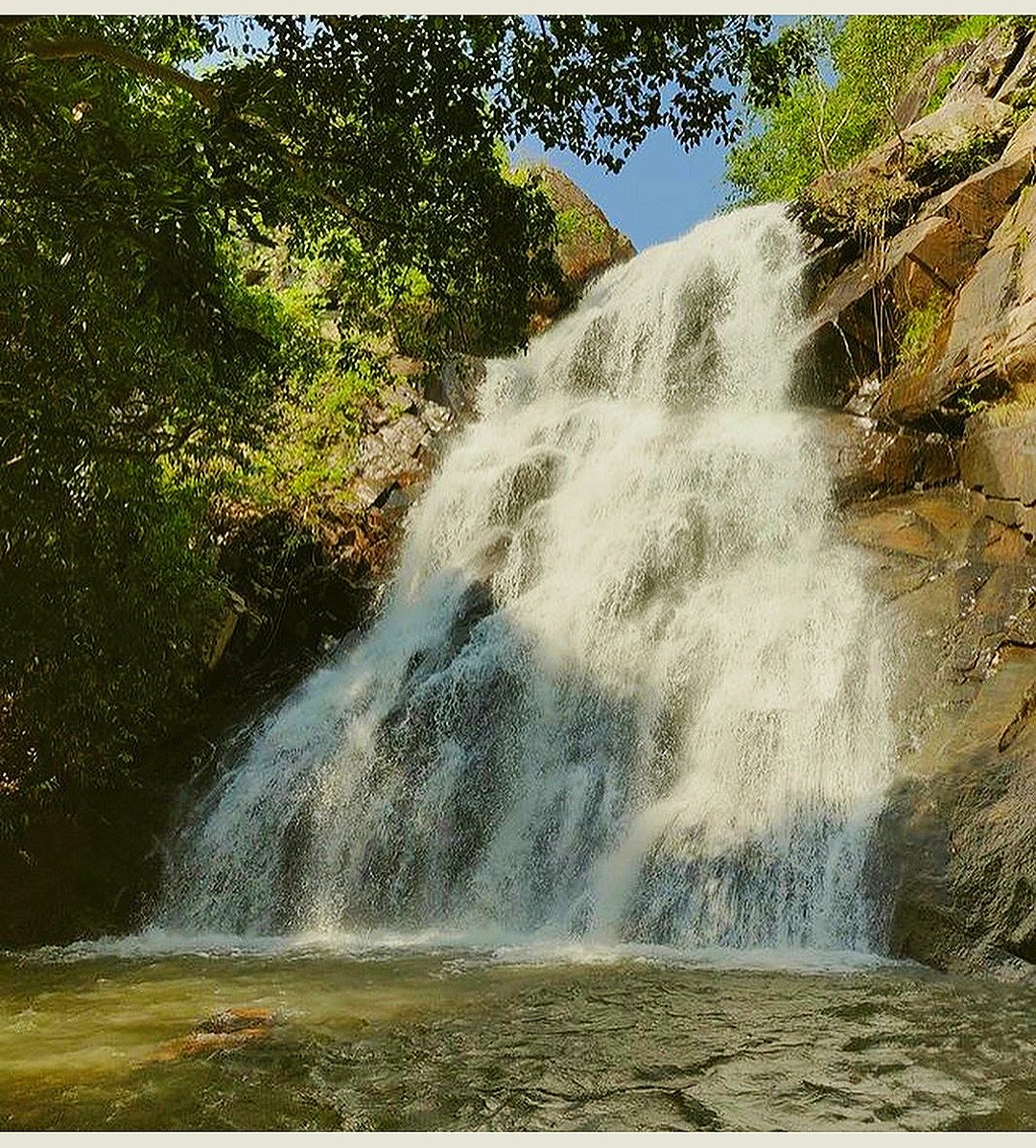
Rama kunda WATERFALL
Rama Kunda is the 1st and topmost waterfall of Sitakund Nala which is the top most waterfall
21°55′37.8″N 86°34′16.2″E IS THE GLOBAL POSITIONING SYSTEM OF RAMA KUNDA WATERFALL
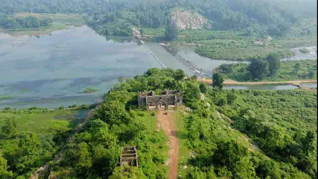
BALIDIHA DAM
BALIDIHA DAM
BALIDIHA DAM about 15 km from Baripada town and about 10 km from our resort. To visit the dam proceed about 06 KM KHASADIHA village and at Khasadiha turn left proceed 4KM to get BALIDIHA DAM. The dam not only a beautiful place but also provide water to to farmer for cultivation. However the Best time of visit from July to November but Please d’nt visit during dry season.
21°57′47.4″N 86°36′45.7″E is the GPS LOCATION BALIDIHA DAM
BALIDIHA DAM ARIEAL VIEW
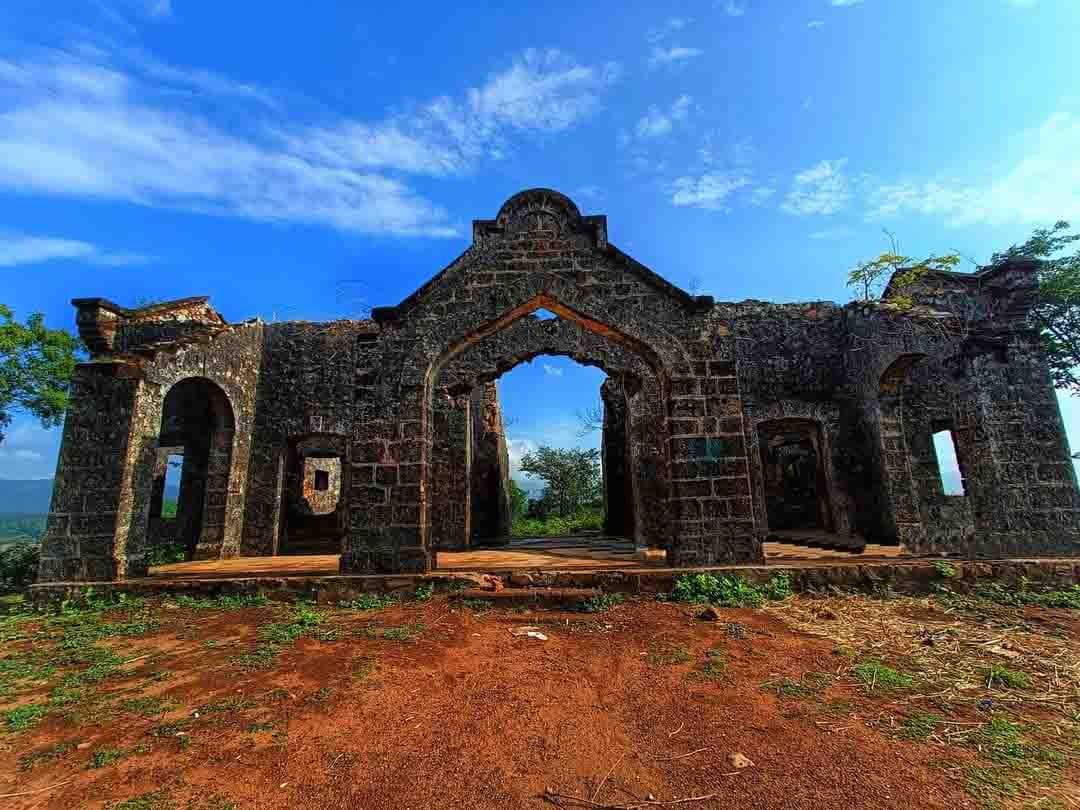
Ruined GUEST HOUSE of BALIDIHA DAM
Mayurbhanj ruller Sri RAM CHANDRA BHANJDEO BALIDIHA DAM GUEST HOUSE constructed in 1912 . During that time from this guest house beautiful scenerires of SIMILIPAL and landscape of Balidiha to Baripada was sighted but Now it is in ruined condition.
DULU DA Waterfall
DULU DA Waterfall is about 20 km from Baripada town, 23 KM from our resort and about 15 km from ShymaKhunta. Hence at ShymaKhunta firstly turn left and proceed about 8KM Sarat Chandra pur village and secondly turn right and procced to Digdigia village about 3KM wchich village is situated at the footfootstep of Similipal, after arriving the foot hill of SIMILIPALand finally one may walk to 1 km foot path road to get DULU DA Waterfall
21°54′10.8″N 86°35′41″E is the GLOBAL POSITIONING SYSTEM OF DULU DA Waterfall
BRAHMAN KUNDA waterfall
BRAHAMAN KUNDA WATERFALL
BRAHMAN KUNDA waterfall is inside Similipal National Park about 50 KM from our resort and 20 km from BHUASUNI also 20 KM from BANGIRIPOSI and about 15 km from SHYMSUNDARPUR. At SHYMSUNDAR PUR firstly turn left and proceed about 12KM LEDAM DAM and Secondly procced to BARIBEDA village finally to BRAHMAN KUNDA Waterfall about 1 KM, from BARIBEDA permission is not necessary to visit BRAHMAN KUNDA Waterfall
22°01′14.8″N 86°25′57.2″E is the GPS Location of BRAHMAN KUNDA waterfall-
Fishes in BRAHAMAN KUNDA WATERFALL
The main attraction of the BRAHMAN KUNDA Waterfall is numerous fishes of the pond come out when puffed rice, Bread powder, Biscuit powder, pop corn etc. are spread over water. The fishes are come out and made competition among themselves for taking of food
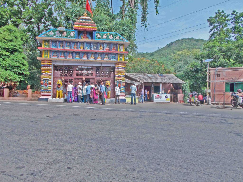
DUARSUNI GHATI HILL
Duarsuni Temple
DUARSUNI Temple road side of NH-45 and is about 3KM from Bangiriposi & about 35KM from our resort. A big fair GHATI MELA is held from January 15th to January 22th Every year .
22°10′02.1″N 86°30′50.1″E is the GLOBAL POSITIONING SYSTEM OF DUARSUNI GHATI
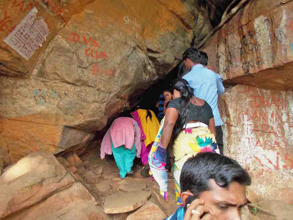
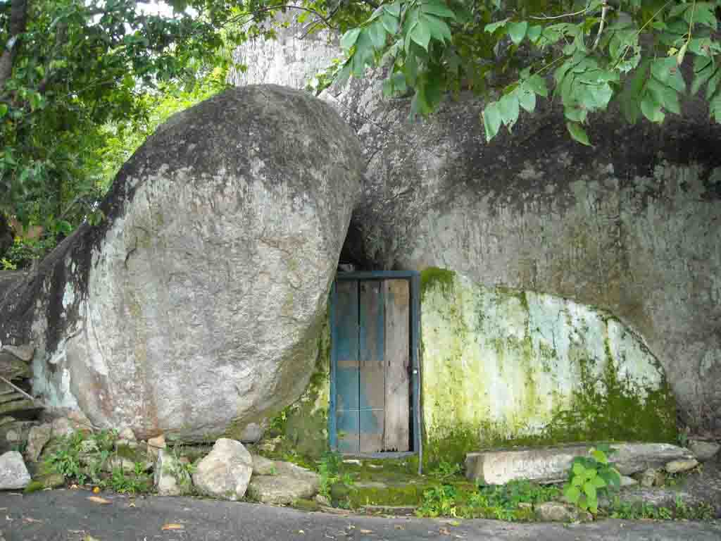
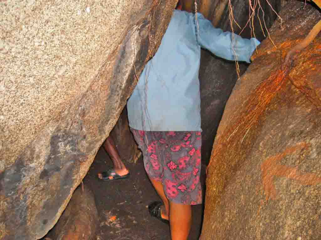
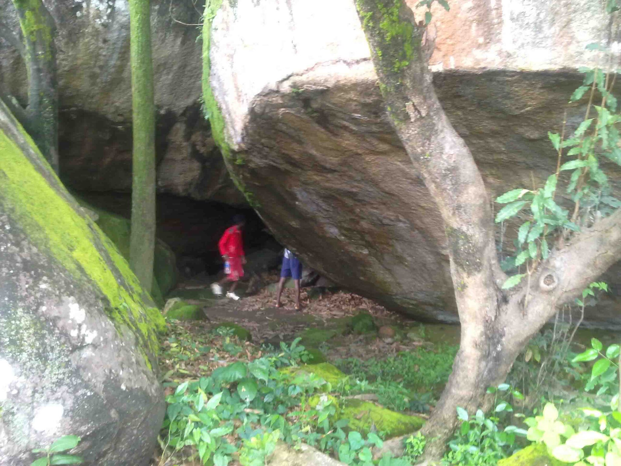
Natural cave of Duarsuni
DUARSUNI Natural Cave in Duwarsuni hill
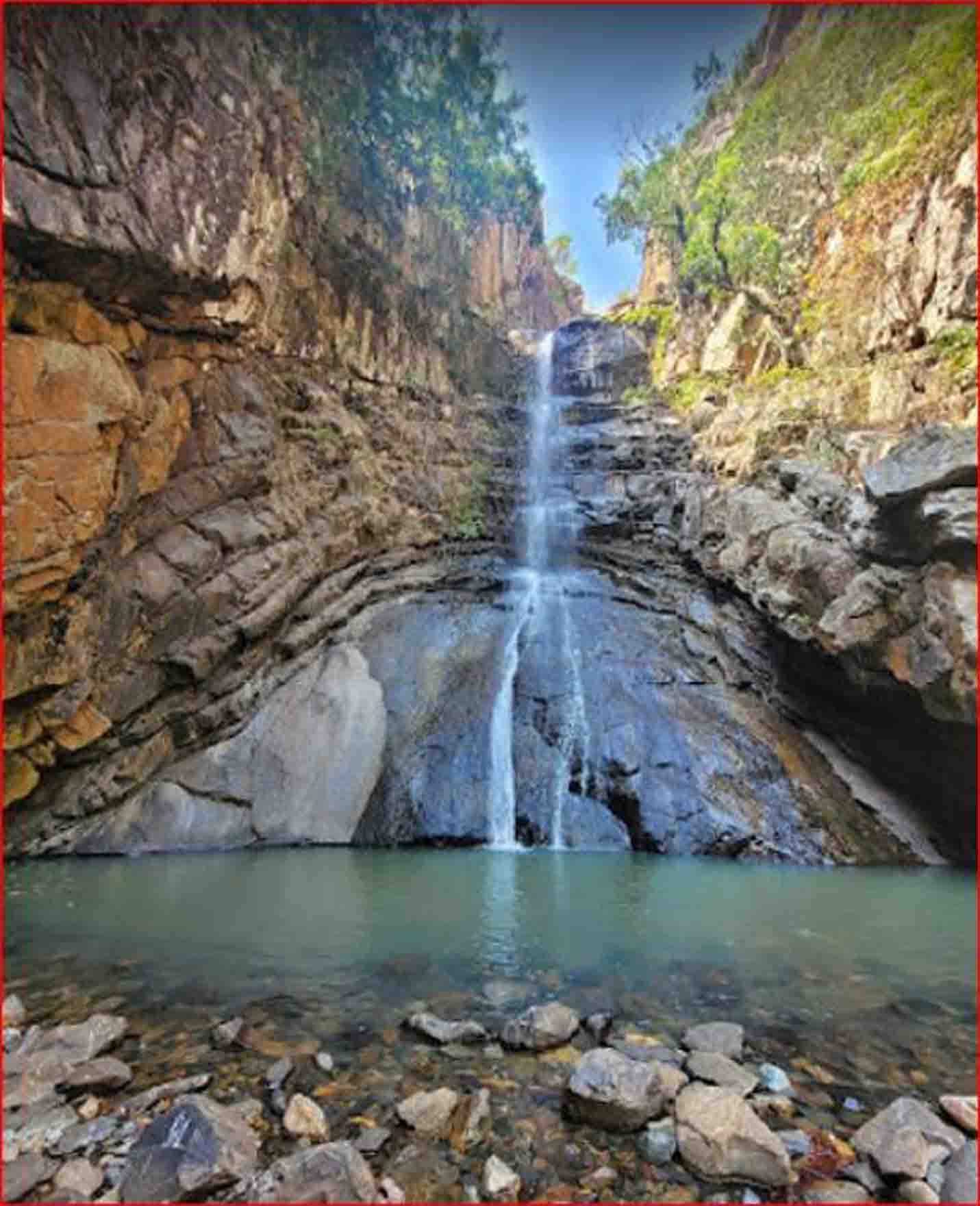
Chaulibhaja Waterfall
CHAULI BHAJA WATERFALL
CHAULI BHAJA Waterfall About 35km from Baripada town,50 KM from our resort and about 15 km from Dukura . After arriving at Dukura firstly turn right and proceed about 10KM Jadunathpur village and secondly procced to Bangali Dahi village about 5KM, after arriving the foot hill of SUN POKHORI hill one may trekking the hill about 900 feet high and finally 3 km foot path road to get Chaulibhaja Waterfall.To visit CHAULI BHAJA requirement of permission is not necessary.
TUNKI Waterfall
21°51′27″N 86°32′50″E is the GPS Location of Chaulibhaja Waterfall –
TUNKI Waterfall
TUNKI Waterfall About 40 km from Baripada town, 55 KM from our resort Via Baunsa Kthia, Badfeni and TADKI JHARAN and via Khunta about 46 KM from Baripada 18 km from Khunta. Concequently at Khunta Firstly turn right and proceed about 8 KM Bhologadia village and secondly again turn left and procced to Rangamatia village about 8 KM, finaly after arring the foot hill of TUNKI one may trekking the hill about 800 feet high and 1 km foot path road to get Tunki Waterfall.
21°47′45.5″N 86°31′29.1″E is the GPS Location of TUNKI Waterfall –
SANA MACHHA KANDNA Waterfall
Sana Machhakandna fall
Permission is not necessay to visit SANA MACHHA KANDNA Waterfall . SANA MACHHA KANDNA Waterfall About 75 KM FROM Sitakund resort,60 km from Baripada town and about 15 km from UDALA. Arriving UDALA firstly turn right and proceed about 12KM PODADIHA village and secondly procced to MONBHANGA village about 1KM, after arring finally walk to 2 km foot path road to get SANA MACHHA KANDNA Waterfall
21°33′03.3″N 86°23′55.6″E is GLOBAL POSITIONING SYSTEM OF SANA MACHHA KANDNA Waterfall
MAINSI GILA WATERFALL
Beautiful MAINSI GILA WATERFALL(LOWER) is about 1KM from Sana Machhakandna Waterfall.
21°32′58.5″N 86°23′37.6″E is the GPS Location of MAINSI GILA WATERFALL(LOWER)
MAINSI-GILA-UPPER-FALL
MAINSI GILA WATERFALL(UPPER) is about 1 KM from Sana-Machha-Kandna Waterfall just 100footsteps upstairs of MAINSI GILA WATERFALL(LOWER)
BHAIRABA KUNDA Waterfall
Vairaba kunda Waterfall
21°38′48.6″N 86°26′49″E is the GPS Location of BHAIRABA KUNDA Waterfall
BHAIRABA KUNDA Waterfall About 70 km from Baripada town, 85 KM from Sitakund Resort and about 20 km from UDALA . AFTER 8km of Udala firstly turn right at BAD KHAMAN and 2ndly proceed about 5KM CHAKRADHARAPUR village and finally to BARA DANGUA village about 3KM, after arriving the foot hill of BHAIRA, one may walk to 1 km foot path road to get BHAIRABA KUNDA Waterfall . one can visit BHAIRABA KUNDA Waterfall without permission.
KANDIA WATERFALL
KANDIA WATERFALL
Sitakund Resort to KANDIA WATERFALLvia TARAJODI & Bhuasuni( Nearest Road)-70KM.
Firstly proceed Bangiriposi to Sankhabhanga-20 KM via Katra-Chandanpur Road on the bank of Katra RIVER. Secondly fom Sankhabhanga Proceed 5 KM to KULAPATA village and finally from KULAPATA village proceed by footpath road about 3KM takes about 1 hour to KANDIAwaterfall.
22°16′42.6″N 86°25′33.3″E IS THE GLOBAL POSITIONING SYSTEM OF KANDIA WATERFALL
BING-DRAHA waterfall
BING DARAHA WATERFALL
BING-DRAHA & Kandia both waterfalls over river KATRA and are inside Similipal National Park . Among these the BING-DRAHA waterfall is about 90 KM from our resort via Bripada & about 80 KM from Sitakund Forest Resort viaTARAJODI & BHUASUNI.
Start journey firstly from Bangiriposi to BISOI-15 KM Naitional High Road NO-45 and Turn RIGHT at BISOI and Secondly Proceed 15 KM in Rairangpur Road to PATPUR. Thirdly from PATUR turn right proceed to SARGADA about 10-KM and forthly from SARGADA proceed to DALEI-DIHI about 5KM and than finally by footpath road about 1KM takes about 20minutes to BING-DRAHAwaterfall.
22°16′56.2″N 86°23′57.4″E is the GPS LOCATION of BING DARAHA WATERFALL-
BHADU-SOLE waterfall
BHADUSOLE WATERFALL
BHADU-SOLE waterfall is inside Similipal National Park about 95 KM from our resort via-TARAJODI & BHUASUNI.
Therefore from Bangiriposi Firstly proceed to HANDIPUHAN-60 KM Naitional High Road NO-45 Secondly Turn left at HANDIPUHAN Proceed to JAMUANI 15-KM and finally From JAMUANI proceed by footpath road about 2KM takes about 1/2 hour to BHADU-SOLE waterfall .
21°56′43.9″N 86°13′46″E is the GPS LOCATION of BHADU-SOLE WATERFALL-
RAMA-JODI WATERFALL
RAMA-JODI WATERFALL
RAMA-JODI WATERFALLinside Similipal national park about 140km from our resortvia TARAJODI & Bhuasuni( Nearest Road)-140KM
From Jashipur vFirstly proceed Tangabila to TATO -7 KM Naitional High Road NO-220 via Jashipur and Secondly at Tato turn left proceed to Lower BarahaKamuda-20KM Again thirdly from Lower BarahaKamuda to Dudhiani -5KM 4thly Dudhiani TO Pahadpur- 5km and finally Pahadpur to RAMA-JODI WATERFALL-5km
21°46′57.2″N 86°12′47.1″E is the GPS LOCATION of RAMA-JODI WATERFALL –
KADALI DARAHA waterfall
KADALI DARAHA WATERFALL
KADALI DARAHA waterfall is inside Similipal National Park about 155 KM from our resort via Bripada & about 145 KM from Sitakund Forest Resort viaTARAJODI & BHUASUNI.
Proceed journey via Jashipr firstly turn left at TATO proceed to village BUDHI GAON -22KM and secondly from BUDHI GAON village proceed by footpath road about 4KM takes about 1 hour to KADALI DARAHA waterfall
21°44′17.3″N 86°10′08.9″E IS THE GLOBAL POSITIONING SYSTEM OF KADALI DARAHA WATERFALL
HATI DARAHA waterfall
HATI DARAHA WATERFALL
HATI DARAHA waterfall is inside Similipal National Park is about 145 KM from Sitakund Forest Resort viaTARAJODI and BHUASUNI. 1KM from Kadali Daraha Waterfall
21°44′21.4″N 86°09′56.3″E is the GPS LOCATION of HATI DARAHA WATERFALL
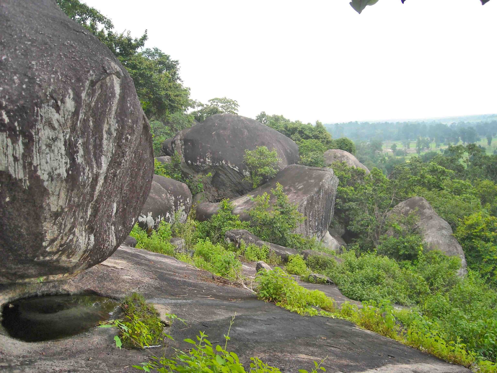
Tirinng Buru hill top
TIRING BURU STONE CAVE OF DEVI BANA DURGA
Tirinng buru of similipal is blessed with abundant natural beauty, natural stone cave, beautiful sighting of peakofmoumtainsof similipal hills, lush green grass meadows & forests make it a perfect destination to relax amidst nature. This spot of similipal make one of the best destinations for trekking ,rock climbing & hiking . On the top hill of Tirinng Buru around the beautiful stone bed enjoy the awe-inspiring views the landscape from a height of 1,000feet. Further it gifts you with memories that last for a lifetime.
The most beautiful hill station Tirinng buru is inside Similipal National Park about 172 KM from Sitakund Forest Resort viaTARAJODI & BHUASUNI.
You can firstly proceed to TATO VIA Jashipur secondly from TATO proceed 40 KM to SELEIBEDA GP Office via- Karanjia and KENDUJIANI and finally from SELEIBEDA GP Office footpath road about 1KM takes about 20 MINUTE to Tirinng buru HILL
Cave OF TIRING BURU
Natural Stone Cave OF TIRING BURU
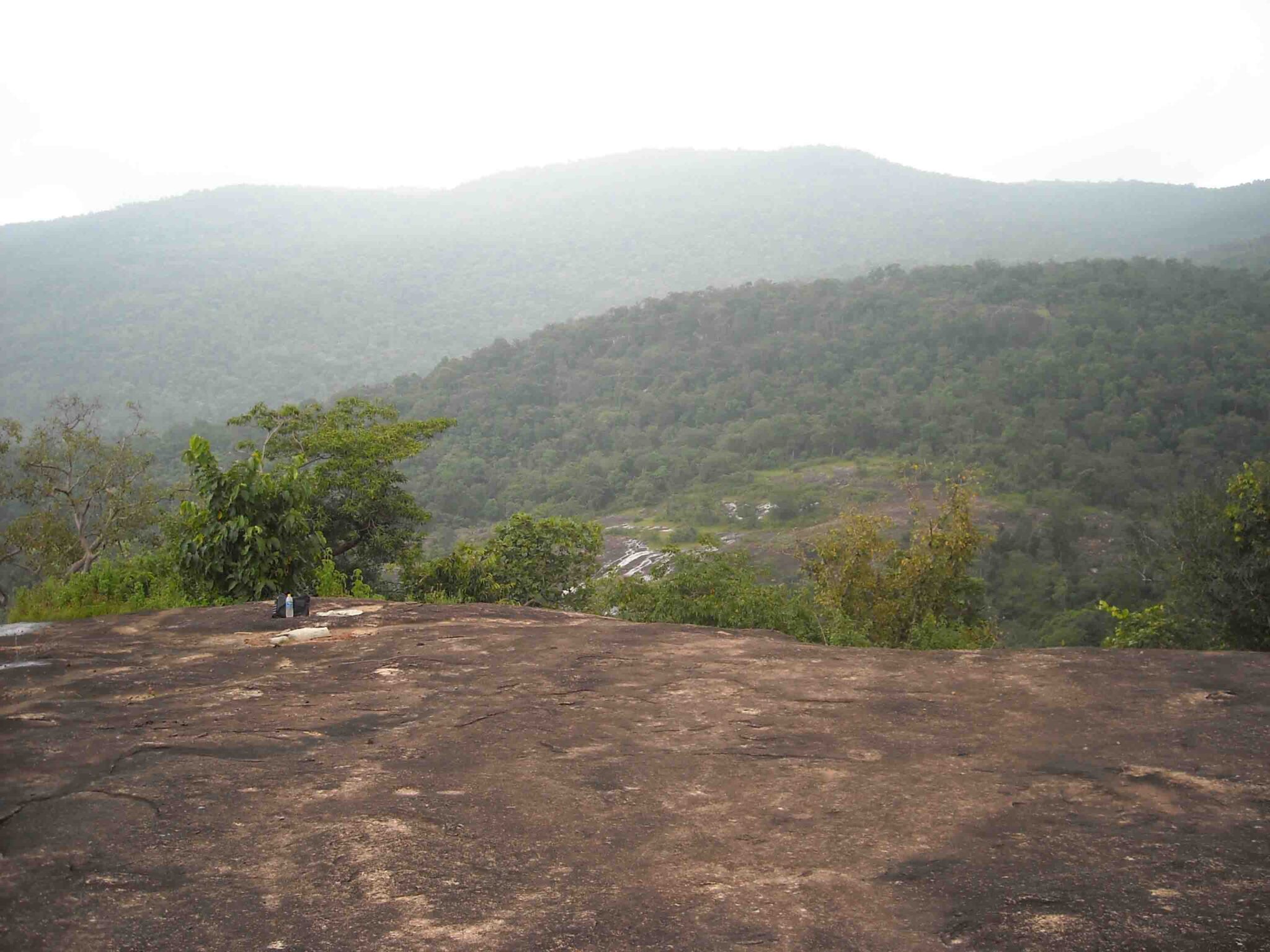
PANORAMIC VIEW FROM TIRING BURU
water fountain over hill of tiring buru
beautiful sighting of peak of moumtains of similipal from stone bed of tiring buru